
By Ethan Siegel![]()
NASA JPL
Later this year, an ambitious new Earth-monitoring satellite will launch into a polar orbit around our planet. The new satellite—called JPSS-1—is a collaboration between NASA and NOAA. It is part of a mission called the Joint Polar Satellite System, or JPSS.
At a destination altitude of only 824 km, it will complete an orbit around Earth in just 101 minutes, collecting extraordinarily high-resolution imagery of our surface, oceans and atmosphere. It will obtain full-planet coverage every 12 hours using five separate, independent instruments. This approach enables near-continuous monitoring of a huge variety of weather and climate phenomena.
JPSS-1 will improve the prediction of severe weather events and will help advance early warning systems. It will also be indispensable for long-term climate monitoring, as it will track global rainfall, drought conditions and ocean properties.
The five independent instruments on board are the main assets of this mission:
- The Cross-track Infrared Sounder (CrIS) will detail the atmosphere’s 3D structure, measuring water vapor and temperature in over 1,000 infrared spectral channels. It will enable accurate weather forecasting up to seven days in advance of any major weather events.
- The Advanced Technology Microwave Sounder (ATMS) adds 22 microwave channels to CrIS’s measurements, improving temperature and moisture readings.
- Taking visible and infrared images of Earth’s surface at 750 meter resolution, the Visible Infrared Imaging Radiometer Suite (VIIRS) instrument will enable monitoring of weather patterns, fires, sea temperatures, light pollution, and ocean color observations at unprecedented resolutions.
- The Ozone Mapping and Profiler Suite (OMPS) will measure how ozone concentration varies with altitude and in time over every location on Earth’s surface. This can help us understand how UV light penetrates the various layers of Earth’s atmosphere.
- The Clouds and the Earth’s Radiant System (CERES) instrument will quantify the effect of clouds on Earth’s energy balance, measuring solar reflectance and Earth’s radiance. It will greatly reduce one of the largest sources of uncertainty in climate modeling.
The information from this satellite will be important for emergency responders, airline pilots, cargo ships, farmers and coastal residents, and many others. Long and short term weather monitoring will be greatly enhanced by JPSS-1 and the rest of the upcoming satellites in the JPSS system.
Want to teach kids about polar and geostationary orbits? Go to the NASA Space Place: https://spaceplace.nasa.gov/geo-orbits/
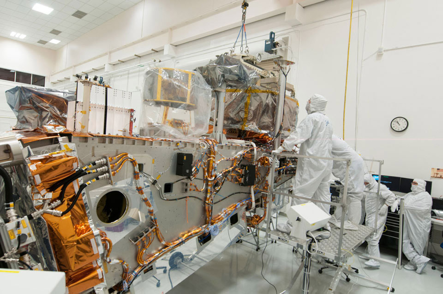
Caption: Ball and Raytheon technicians integrate the VIIRS Optical and Electrical Modules onto the JPSS-1 spacecraft in 2015. The spacecraft will be ready for launch later this year. Image Credit: Ball Aerospace & Technologies Corp.
This article is provided by NASA Space Place. With articles, activities, crafts, games, and lesson plans, NASA Space Place encourages everyone to get excited about science and technology. Visit spaceplace.nasa.gov to explore space and Earth science!