
Asian Tsunami Seen from Space
by Patrick L. Barry
When JPL research scientist Michael Garay first heard the news that a tsunami had struck southern Asia, he felt the same shock and sadness over the tremendous loss of human life that most people certainly felt. Later, though, he began to wonder: were these waves big enough to see from space?
So he decided to check. At JPL, Garay analyzes data from MISRthe Multi-angle Imaging SpectroRadiometer instrument aboard NASA's Terra satellite. He scoured MISR images from the day of the tsunami, looking for signs of the waves near the coasts of India, Sri Lanka, Indonesia, and Thailand.
Looking at an image of the southern tip of Sri Lanka taken by one of MISR's angled cameras, he spotted the distinct shape of waves made visible by the glint of reflected sunlight. They look a bit like normal waves, except for their scale: These waves were more than a kilometer wide!
Most satellites have cameras that point straight down. From that angle, waves are hard to see. But MISR is unique in having nine cameras, each viewing Earth at a different angle. "We could see the waves because MISR's forward-looking camera caught the reflected sunlight just right," Garay explains.
In another set of images, MISRs cameras caught the white foam of tsunami waves breaking off the coast of India. By looking at various angles as the Terra satellite passed over the area, MISRs cameras snapped seven shots of the breaking waves, each about a minute apart. This gave scientists a unique time-lapse view of the motion of the waves, providing valuable data such as the location, speed, and direction of the breaking waves.
Realizing the importance of the find, Garay contacted Vasily Titov at the National Oceanic and Atmospheric Administrations Pacific Marine Environmental Laboratory in Seattle, Washington. Titov is a tsunami expert who had made a computer simulation of the Asian tsunami.
"Because the Indian Ocean doesn't have a tsunami warning system, hardly any scientific measurements of the tsunami's propagation exist, making it hard for Dr. Titov to check his simulations against reality," Garay explains. "Our images provide some important data points to help make his simulations more accurate. By predicting where a tsunami will hit hardest, those simulations may someday help authorities issue more effective warnings next time a tsunami strikes."
Find out more about MISR and see the latest images at www-misr.jpl.nasa.gov/. Kids can read their own version of the MISR tsunami story at
http://spaceplace.nasa.gov/en/kids/misr_tsunami.This December 26, 2004, MISR image of the southern tip of Sri Lanka
was taken several hours after the first tsunami wave hit the island. It was taken
with MISRs 46° forward-looking camera. This article was provided by the Jet Propulsion Laboratory, California
Institute of Technology, under a contract with the National Aeronautics and Space
Administration.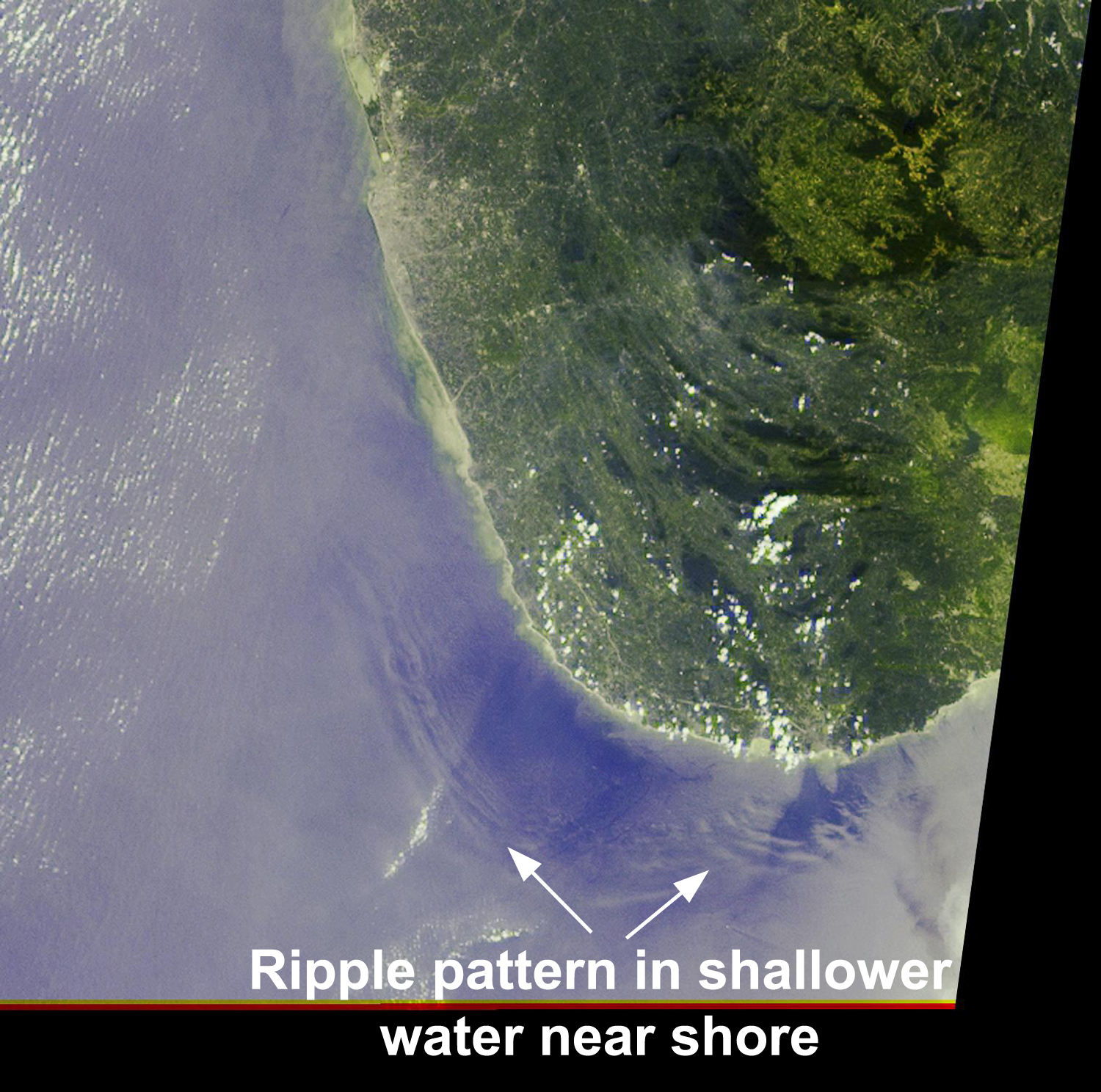
All content is the responsibility of LUNAR.
If you have comments or suggestions regarding these web pages,
please contact the 
Copyright © 1992 - 2026 LUNAR